LOOKING BACK !
Welcome to the Recollections of my Old Man!

PANAMA CANAL
Republic of Panama

PANAMA CANAL

Republic of Panama
Panama, officially the Republic of Panama, is a country at the southern end of Central America, bordering South America. It is bordered by Costa Rica to the west, Colombia to the southeast, the Caribbean Sea to the north, and the Pacific Ocean to the south. Its capital and largest city is Panama City, whose metropolitan area is home to nearly half of the country's over 4 million inhabitants.
Welcome to our vibrant visual journey through the Panama Canal!

This man-made marvel of engineering, connecting the Atlantic and Pacific Oceans, is a stunning fusion of ingenuity and natural beauty.
With a collection of captivating images, we'll transport you through the canal's locks, its lush surroundings, and the ships and vessels that traverse this vital waterway.
Whether you're an avid explorer, history enthusiast, or simply love to admire impressive feats of human achievement, our gallery promises to offer a window into the heart of the Panama Canal.
Dive in and discover the wonders that make this canal a true icon of global trade and travel.
Panama Canal
Linking Oceans! Linking the Worlds!


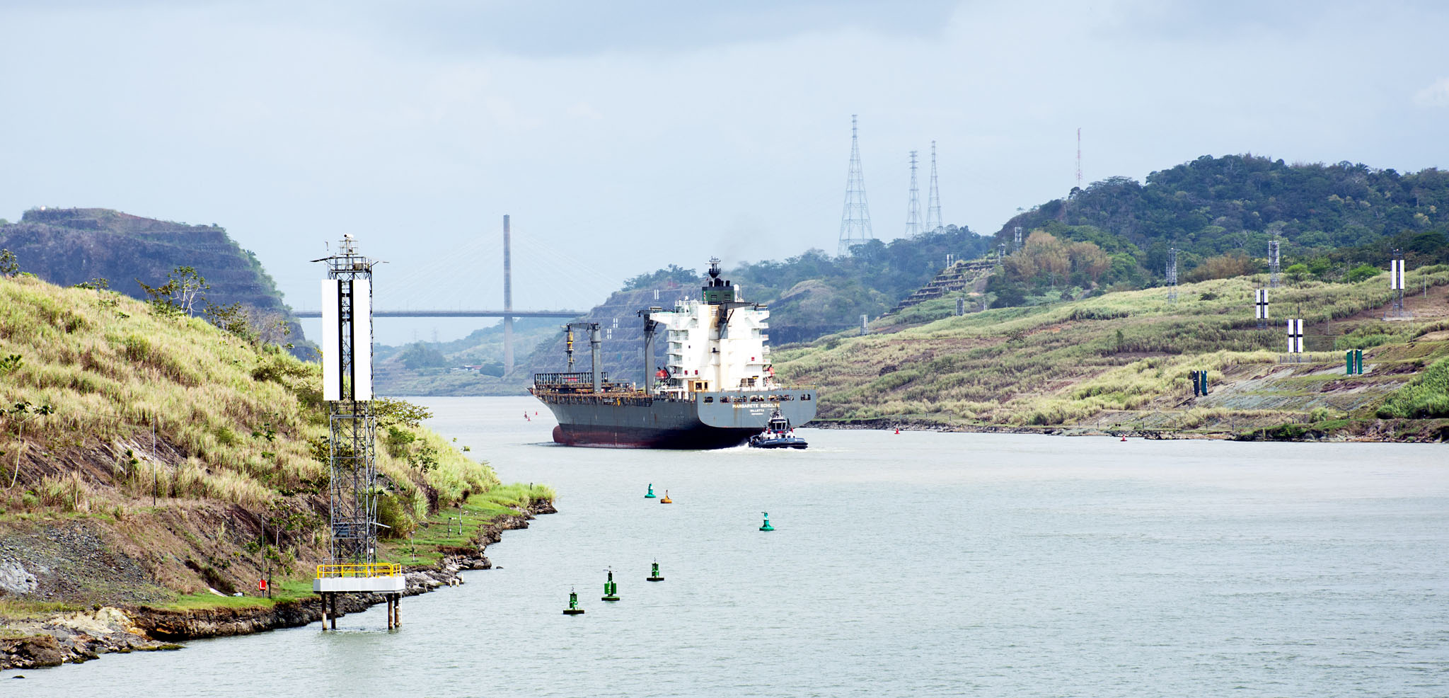
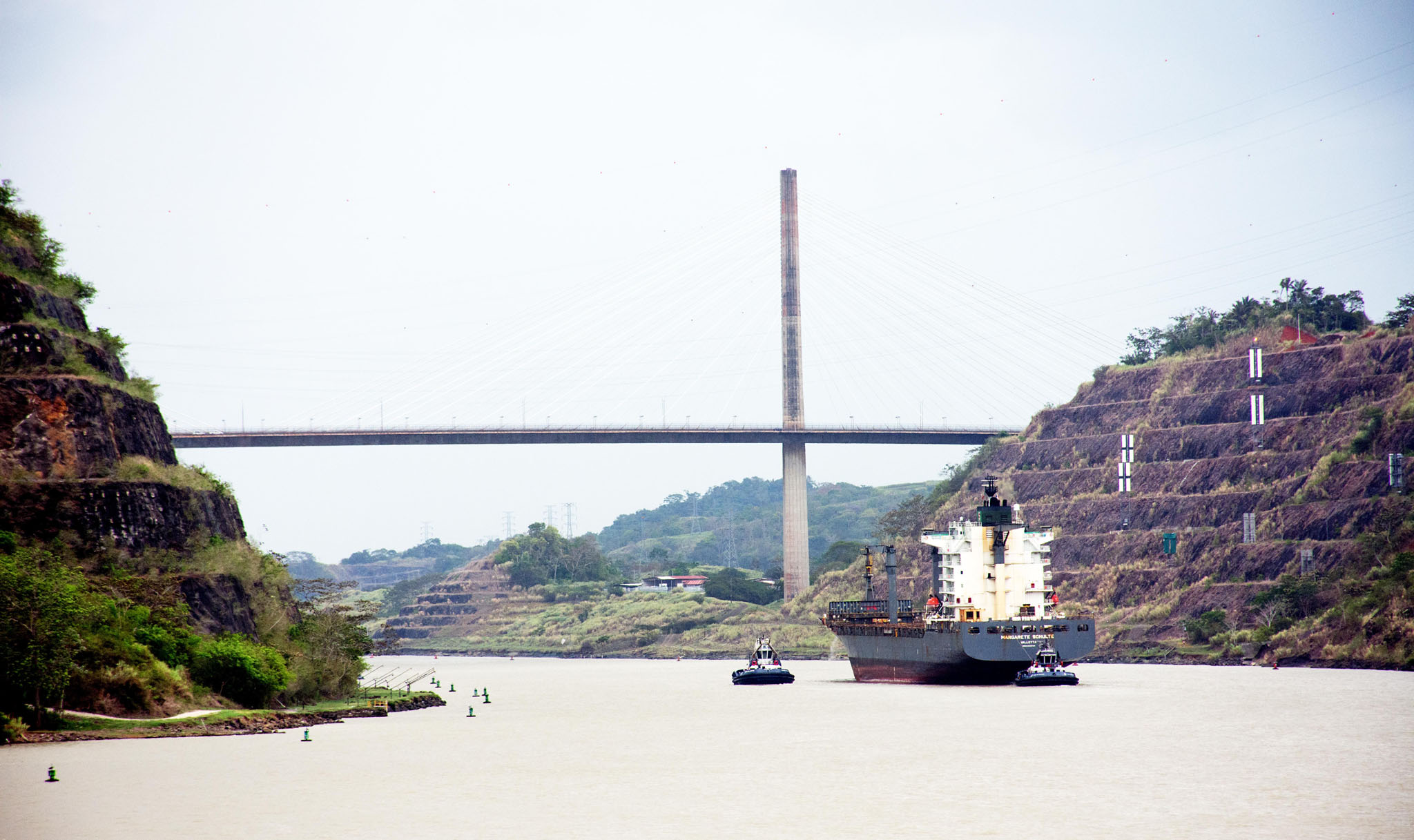
MARGARETE SCHULTE (IMO: 9302944) is a Container Ship and is sailing under the flag of Malta. Her length overall (LOA) is 210 meters and her width is 30.13 meters.


EURODAM (IMO: 9378448) is a Passenger Ship and is sailing under the flag of Netherlands. Her length overall (LOA) is 285.43 meters and her width is 32.26 meters

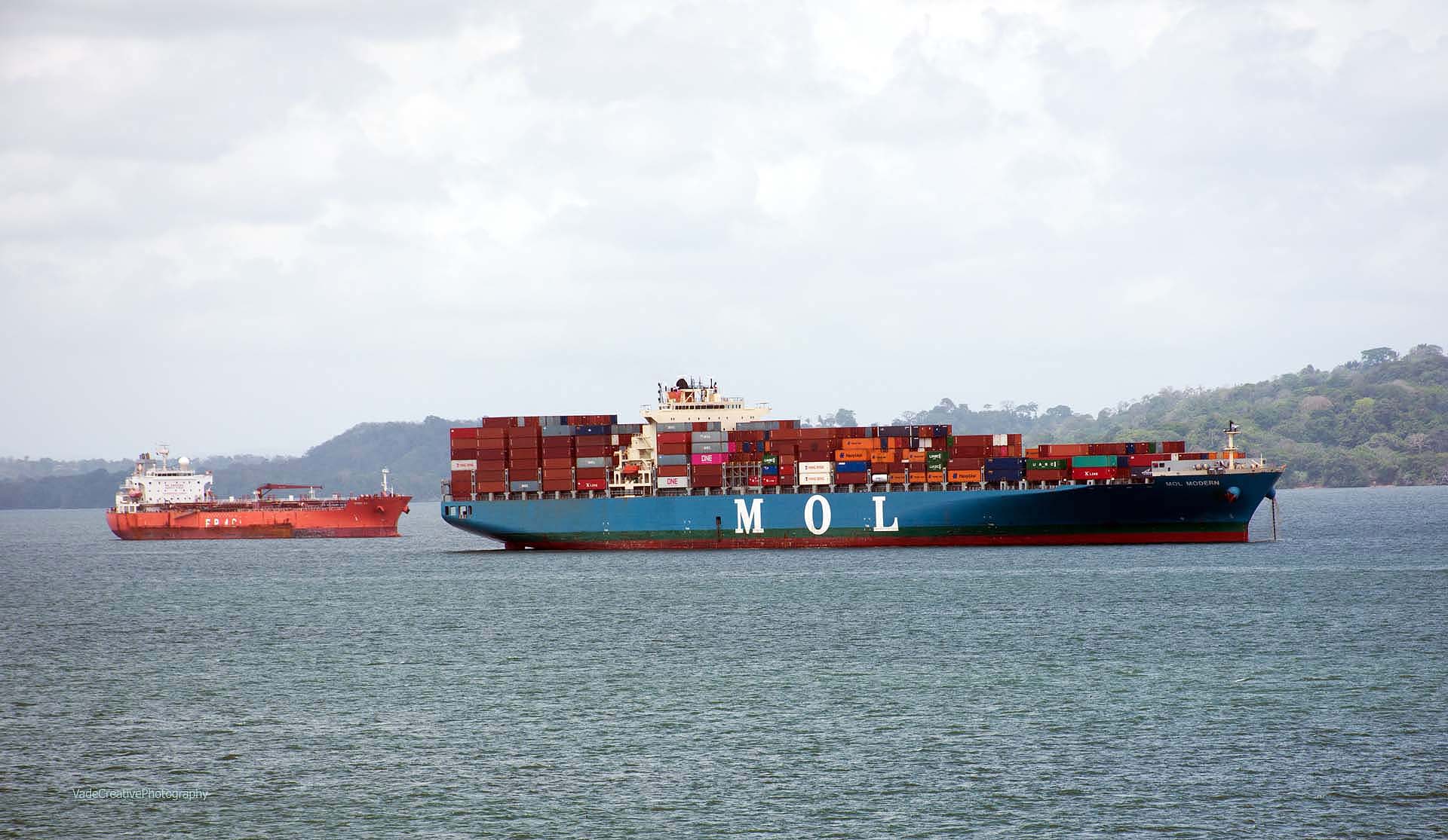
Please note how close is the ship sailing in the opposite direction.
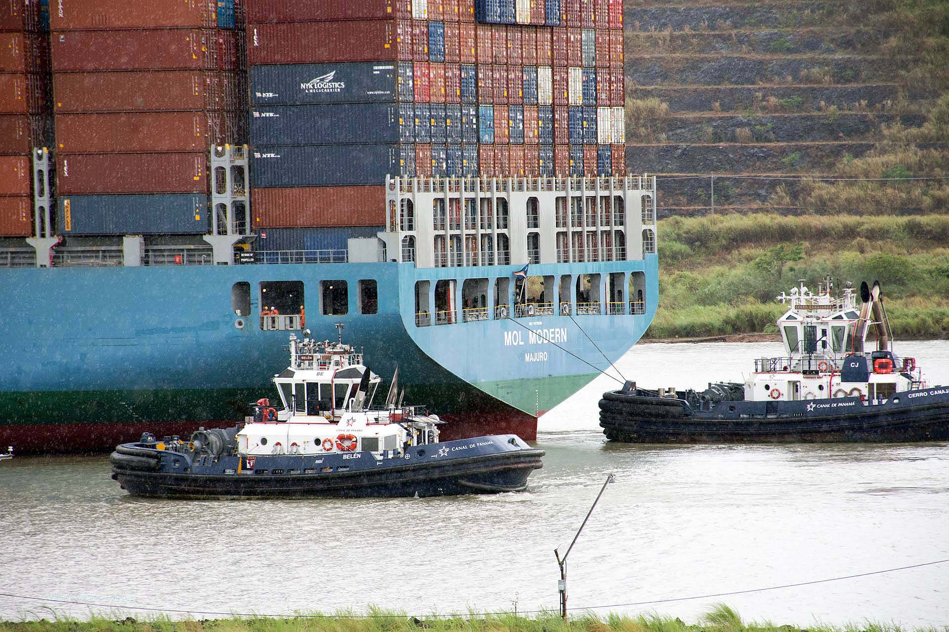
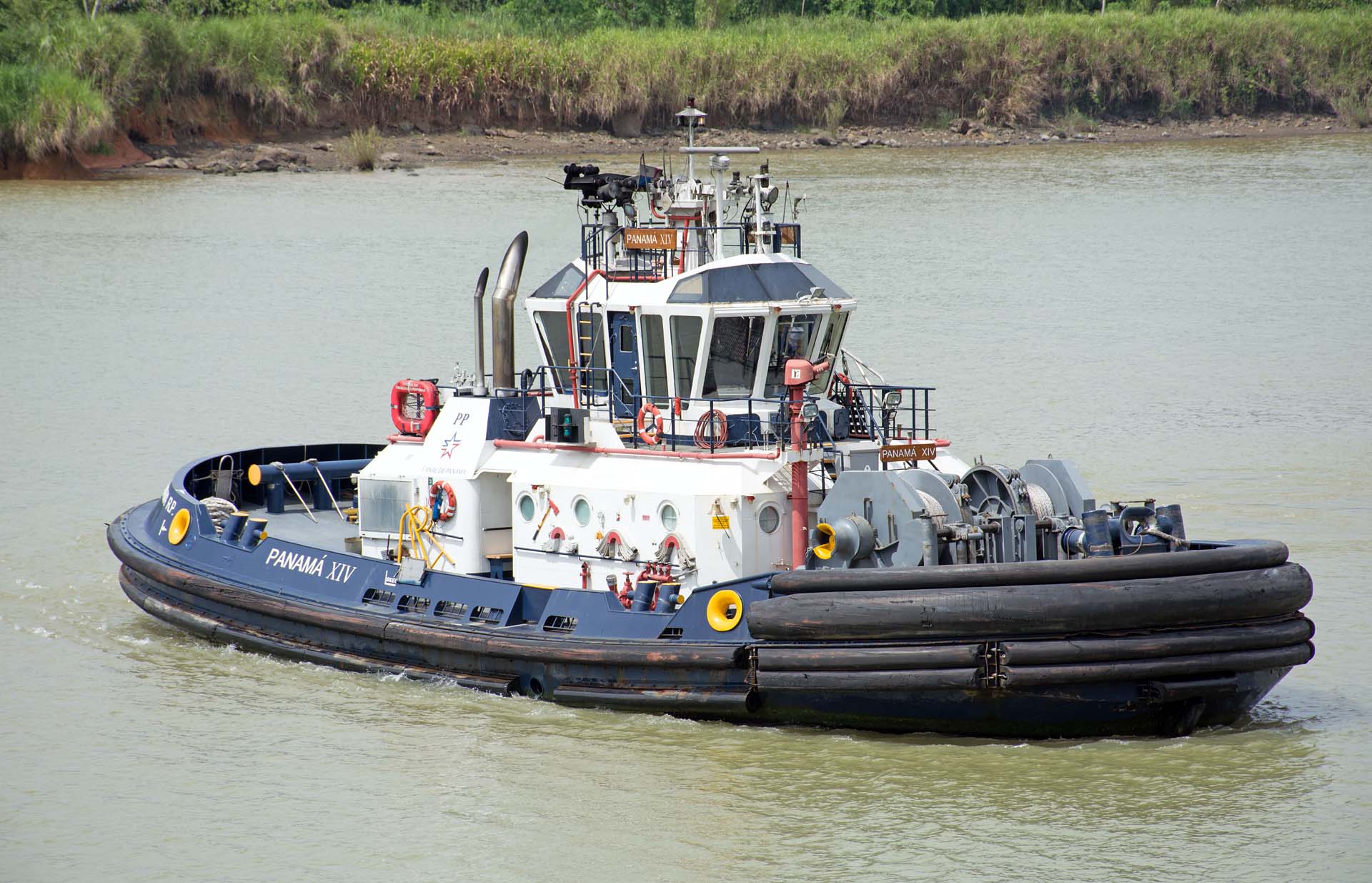
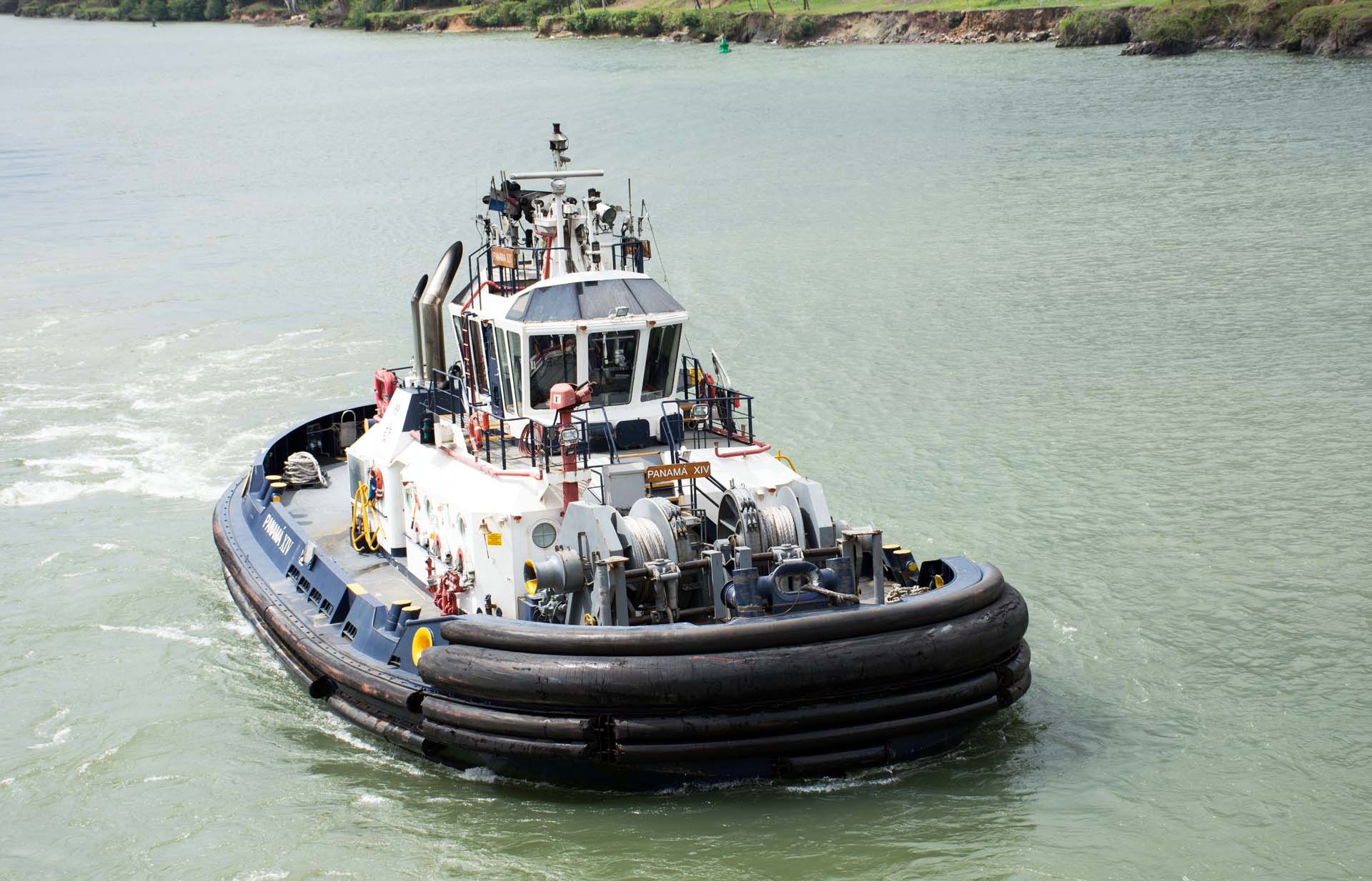
Electric mules, also known as electric locomotives, play a crucial role in the operation of the Panama Canal. These mules are used to guide ships through the canal's lock chambers, ensuring safe and efficient passage
Safety: The use of electric mules enhances the safety of the canal operations. By providing precise control over the movement of ships, they reduce the risk of accidents and damage to both the vessels and the canal infrastructure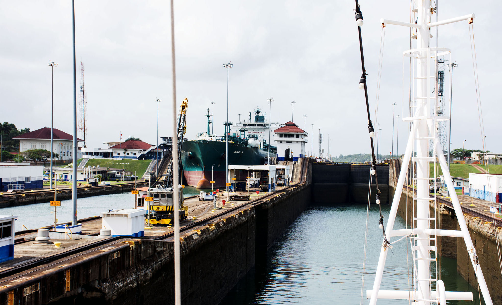
Please note approaching ship Jenny N IMO 9377248 (to 2019, now Tokyo), Lpg Tanker, 36,459 tons, Length: 205 m, Beam: 32.2 m, Draught: 12.1 m, travelling in the opposite direction in adjecent canal.
Please note approaching ship Jenny N IMO 9377248 (to 2019, now Tokyo), Lpg Tanker, 36,459 tons, Length: 205 m, Beam: 32.2 m, Draught: 12.1 m, travelling in the opposite direction in adjecent canal. 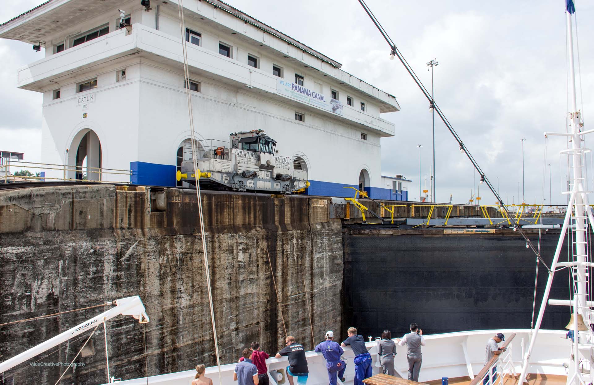


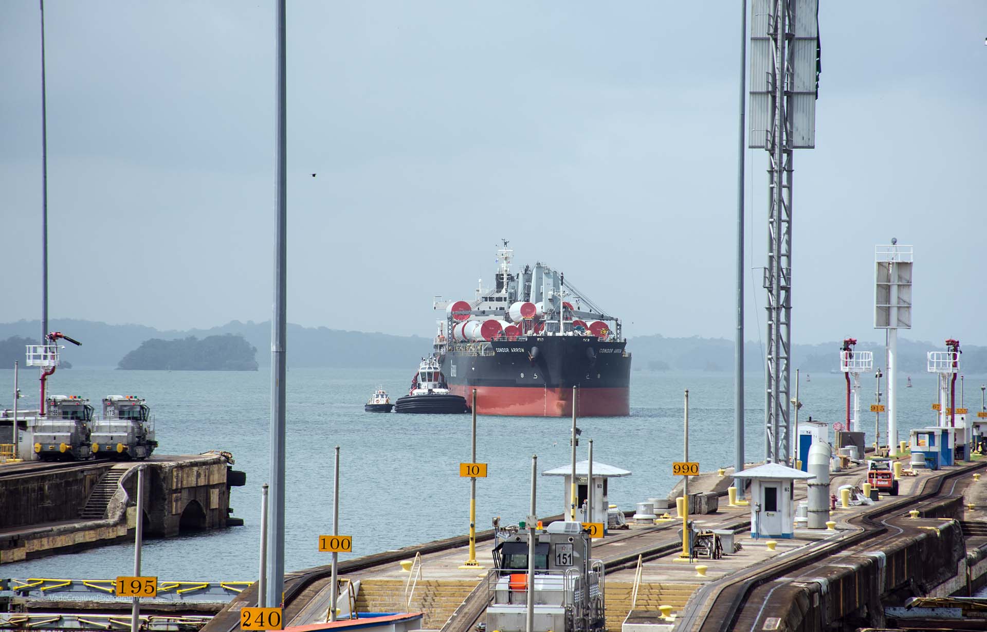
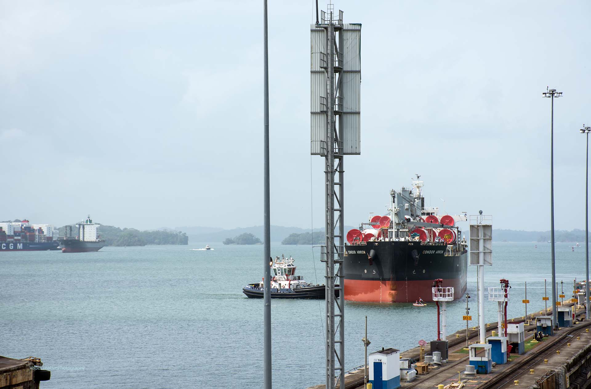
CONDOR ARROW (IMO: 9552886) is a Bulk Carrier and is sailing under the flag of Panama. Her length overall (LOA) is 199.98 meters and her width is 32.26 meters
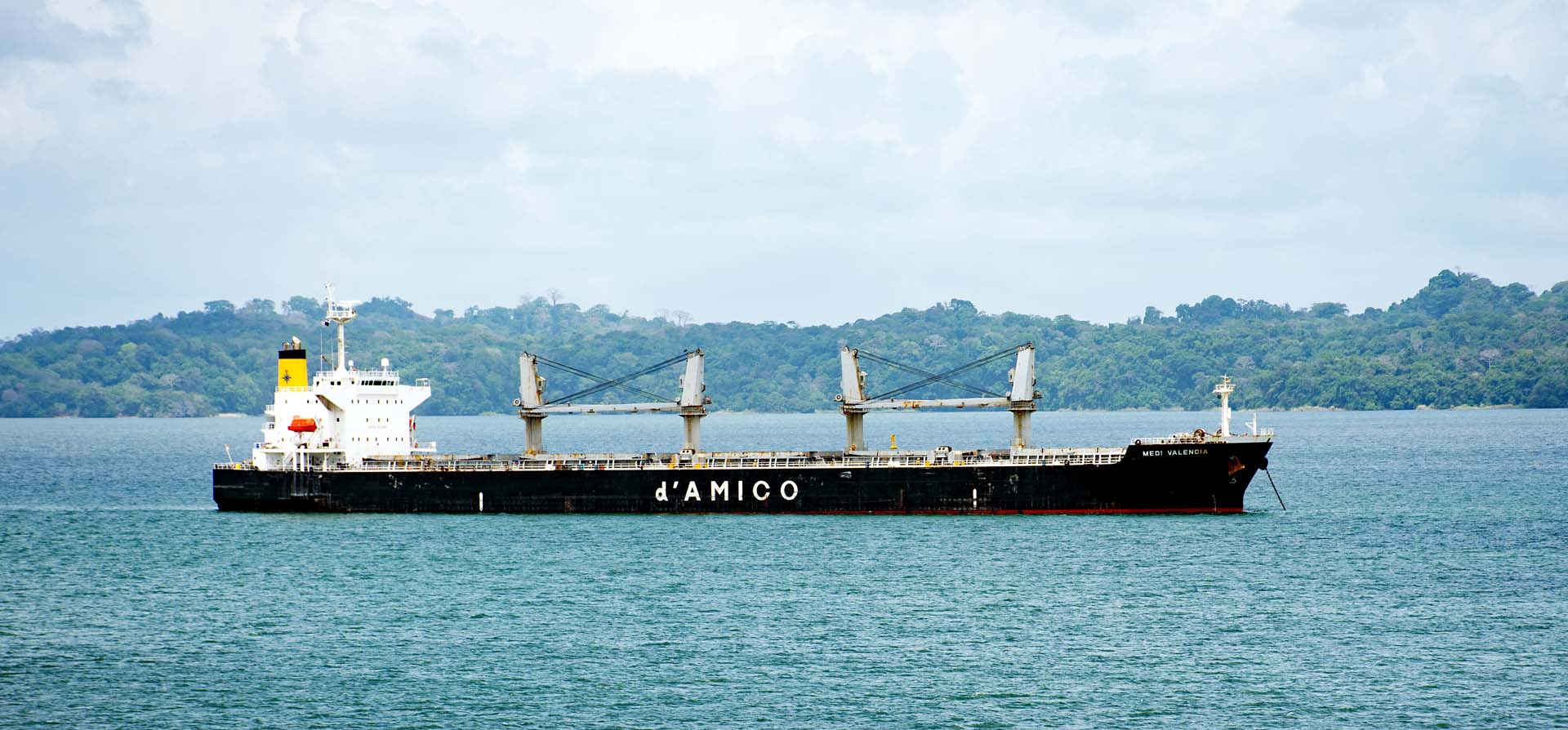
ENTERING GATUN LAKE


SHIPS WAITING FOR TRANSIT THROUGH CANAL
A long time ago, year 2018

waiting their turn for transit through Panama Canal

waiting their turn for transit through Panama Canal

waiting their turn for transit through Panama Canal

ALGOMA VISION (IMO: 9640944) is a Self Discharging Bulk Carrier and is sailing under the flag of Marshall Is. Her length overall (LOA) is 228.6 meters and her width is 32.26 meters.

APINE MYSTERY, previosly known as SEAWAYS MYSTERY (IMO: 9392808) is a Oil/Chemical Tanker and is sailing under the flag of Marshall Is. Her length overall (LOA) is 183.21 meters and her width is 32 meters
We could not find any IMO ship details; may have changed name and operator

BULK BOLIVIA (IMO: 9775139) is a Bulk Carrier and is sailing under the flag of Panama. Her length overall (LOA) is 199.98 meters and her width is 32.24 meters.

BULK BOLIVIA (IMO: 9775139) is a Bulk Carrier and is sailing under the flag of Panama. Her length overall (LOA) is 199.98 meters and her width is 32.24 meters.

Formerly known as CAPTAIN DIMITRIS (IMO: 9797694) is a Bulk Carrier and is sailing under the flag of Marshall Is. Her length overall (LOA) is 199.92 meters and her width is 32.26 meters.

Previously known as ROCK (IMO: 9288356) is a Crude Oil Tanker and is sailing under the flag of Barbados. Her length overall (LOA) is 228 meters and her width is 32.27 meters

Previously known as KRITI BAY (IMO: 9418573) is a Oil/Chemical Tanker and is sailing under the flag of Liberia. Her length overall (LOA) is 183 meters and her width is 32.23 meters
Previously known as FOS EXPRESS (IMO: 9348699) is a Container Ship and is sailing under the flag of Liberia. Her length overall (LOA) is 294.1 meters and her width is 32.29 meters.

MARGARETE SCHULTE (IMO: 9302944) is a Container Ship and is sailing under the flag of Malta. Her length overall (LOA) is 210 meters and her width is 30.13 meters.